Christmas Island - An Amazing Ecotourism Destination
Christmas Island, formerly known as the Territory of Christmas Island, is an island in the Indian Ocean that is governed as an Australian external territory. It is located about 224 miles (360 km) south of the island of Java and 1,400 miles (1,600 km) northwest of Australia. The island is at the top of an oceanic mountain, and Murray Hill, in the western section of the island, is its highest point, rising to a height of 1,184 feet.
Author:Jane RestureSep 30, 2022833 Shares208.1K Views

ChristmasIsland, formerly known as the Territory of Christmas Island, is an island in the Indian Ocean that is governed as an Australian external territory. It is located about 224 miles (360 km) south of the island of Java and 1,400 miles (1,600 km) northwest of Australia.
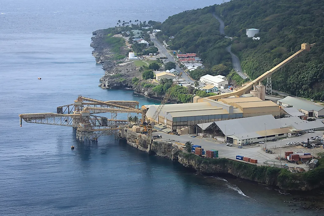
The island is at the top of an oceanic mountain, and Murray Hill, in the western section of the island, is its highest point, rising to a height of 1,184 feet. On the northeastern side of the island, Flying Fish Cove is where the primary village and port are located.
The island was named on Christmas Day 1643 by Captain William Mynors of the British East India Company after Richard Rowe, master of the Thomas, who made the first known sighting of it in 1615.
The crew of the HMS Egeria gathered soil and rock samples in 1887; British naturalist John Murray examined the samples and discovered that they were almost all phosphate of lime.
History Of Christmas Island
Richard Rowe of the Thomas was the first European to see the island in 1615. On Christmas Day in 1643, the English East India Company ship Captain William Mynors of the Royal Mary gave the island its name.
Early in the 17th century, the island was marked on English and Dutch navigational charts, although Pieter Goos, a Dutch cartographer, did not mark the island on a map until 1666. Goos gave the island the mysterious names "Mony" or "Moni."
The first known voyage to the area around the island was undertaken in March 1688 by English explorer William Dampier while sailing on board Cygnet, a privateer ship owned by Charles Swan.
He discovered no one there. Dampier documented the trip in writing. Dampier was traveling from New Holland to Cocos. His ship was blown off course in an easterly direction, and it took it 28 days to reach Christmas Island.
At "the Dales," Dampier set down on the West Coast. The first Europeans to step foot on Christmas Island were two of his crew members. A Voyage to and from the Island of Borneo, in the East Indies, written by Captain Daniel Beeckman of the Eagle in 1718, describes the island's passage on 5 April 1714.
Things To See And Do On Christmas Island
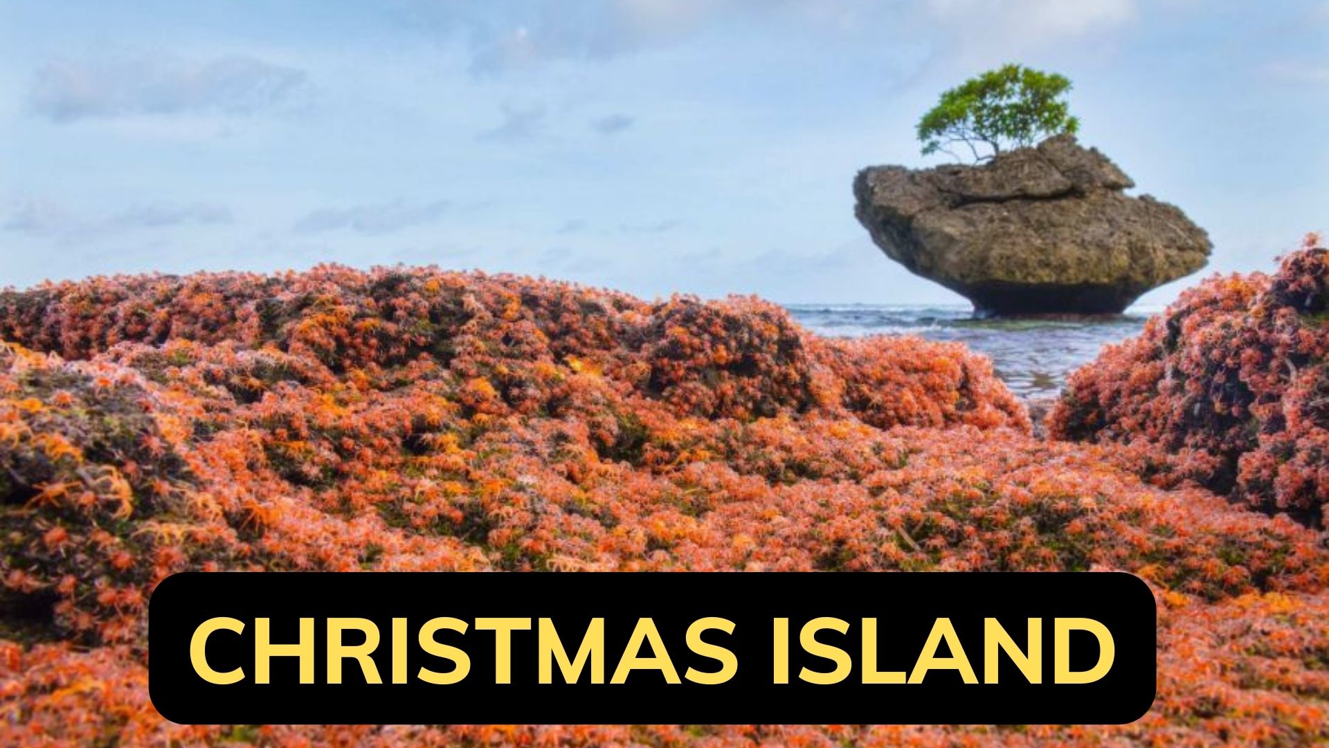
- Red Crab Migration.
- Scuba Diving.
- Photography.
- Bird Watching.
- Eating Out.
- Tours.
Climate Of Christmas Island
It has a tropical climate, where trade winds control the heat and humidity. Throughout the year, temperature variations are minimal. The lowest temperature, 23 °C, happens in August, while the maximum temperature is often around 29 °C in March and April. Between July and October, there is a dry season with sporadic precipitation.
From November through June, there are monsoons, which bring sudden downpours of rain. The rainy season is when tropical cyclones also develop, bringing with them extremely powerful winds, heavy rain, and very high waves.
Christmas Island Hotels
- VQ3 Lodge.
- The Sunset.
- The Cocos Padang Lodge.
- Island Time Guest Room.
- Mango Tree Lodge.
- Christmas Island Apartments.
People Also Ask
Can You Stay On Christmas Island?
There are hotels and resorts on Christmas Island for every price range.
How Do You Get To Christmas Island?
From Perth on Australia's west coast, a direct flight to Christmas Island takes around four hours.
Is Christmas Island Part Of Wa?
Christmas Island is an Australian territory, and Indonesia, which is located roughly 350 km to the north, is Christmas Island's closest neighbor.
Conclusion
One of the islands in the Indian Ocean, Christmas Island, is located about 1,550 km northwest of Australia and south of Indonesia. It is a territory of that country. Around 1,800 people lived there in 2016, representing a mixture of Straits Chinese, Malay, Australian, and other ethnic groups.

Jane Resture
Author
Since she embarked on her first world trip in 2002, Jane Resture spent the past decades sharing her personal journey and travel tips with people around the world. She has traveled to over 80 countries and territories, where she experienced other cultures, wildlife she had only read about in books, new foods, new people, and new amazing experiences.
Jane believes that travel is for everyone and it helps us learn about ourselves and the world around us. Her goal is to help more people from more backgrounds experience the joy of exploration because she trusts that travel opens the door to the greatest, most unforgettable experiences life can offer and this builds a kinder, more inclusive, more open-minded world.
Latest Articles
Popular Articles
